The impact of FDR's New Deal can still be felt around Maine
A road trip through some New Deal sites still standing in the state

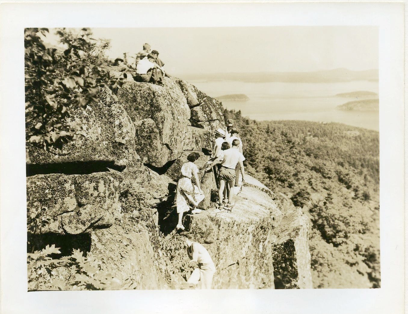
At the risk of romanticizing what was a painful era in American history: I’m kind of obsessed with Franklin D. Roosevelt’s New Deal.
I try to put myself into the nightmare scenario that was the early years of the Great Depression. In the midst of massive income inequality, the stock market tanks and the country plunges into an economic abyss. People are starving, losing their jobs, losing their homes. High tariffs imposed by a deeply unpopular president cause further economic pain. Sorry, I’m suddenly confused about what year I’m in. 1930. We’re talking about 1930. Got it.
One of the main ways the country dug itself out of that gigantic, destructive mess was through big, transformative infusions of federal resources, in the form of purposeful programs designed to create jobs and improve people’s lives. That’s what the New Deal was, in all the many forms it took.
In addition to social security (shoutout to my girl Frances Perkins!) and vitally important labor, banking, investment and agricultural reforms, FDR’s New Deal also went all in on huge building and development projects all across the country. Here in Maine, more than 300 projects spearheaded by the New Deal’s Civilian Conservation Corps and Works Progress Administration transformed the landscape of the state, building hundreds of miles of new roads, improved bridges, water and sewer upgrades, renovations to schools and other municipal buildings and many more. It created much of Maine’s tourism infrastructure, which relies heavily on access to the natural world in the form of federal and state parks, and which is now Maine’s most important industry. And it dragged a state that, in some areas, was still living in the 19th century into the 20th.
Unlike other transformative federal projects like the Great Society of the 1960s, physical reminders of the New Deal are everywhere you look around Maine, and the country at large. The incredible and comprehensive Living New Deal website documents all of these sites, extant and not. Be warned: if you are a history person, you will be stuck on this site for hours.
I think one of the reasons we struggle as a society to tackle the biggest and thorniest programs in our country - income inequality, healthcare, housing, transitioning to clean energy - is because we have so few models for such change in most of our lifetimes. It’s been more than 50 years since the last of Lyndon Johnson’s Great Society reforms were enacted, and since then, these types of transformative efforts have not only not occurred - they have been actively avoided by people in our government that would rather see those resources go to private companies, in the assumption that the “free market” will do it (spoiler alert: in most cases, they will not). If we don’t see change happen, we don’t think it’s possible. If we don’t witness good works being built, we don’t think they will ever happen.
When I walk around my neighborhood or drive through cities and towns in Maine and elsewhere, I always want to know why this or that building looks the way it does, or sits where it sits. And when I see things that were created in a time when Americans dared to dream big - and our government had the will and desire to meet that dream - I can cling to the hope that maybe, someday, we could all do it again.
Here are some of those New Deal sites in Maine and, specifically, in eastern Maine, that I find particularly interesting. You probably already know about some of them. I can’t recommend the Living New Deal site enough if you want to know more. It’s even got this incredibly well-designed map feature! God, I love a map feature.
Almost every single airport in the state of Maine
Nearly every airport still operating in Maine today was either built or significantly improved and expanded by New Deal programs. In particular, airports in Augusta, Belfast, Biddeford, Brunswick, Caribou, Houlton and Trenton were entirely constructed utilizing federal funds, and were built by Civil Works Administration and Works Progress Administration workers. Established airports like those in Bangor and Portland got new runways and terminals that allowed them to greatly expand service, and tiny airstrips in towns like Baring, Dexter, Pittsfield and Princeton were built to expand air access across rural Maine. Nationally, more than 300 airports were built or upgraded - creating, essentially, the foundation of the entire aviation industry in the U.S.
Acadia National Park
Perhaps the most visible and enduring of all the New Deal projects in Maine, the improvement and expansion of Acadia National Park between 1933 and 1942 transformed what was then 50,000 rustic, largely untouched acres into the beloved park that it is today - the seventh most-visited national park in the country, and a statewide economic engine that is by far the most popular tourist destination in Maine.
Among the major works undertaken during those nine years were clearing thousands of dead trees and associated debris and building fire protection infrastructure, the construction of two campgrounds, and the building of most of the park’s miles of distinctive, granite-lined hiking trails. Over the course of those years, thousands of people were employed by the Civil Conservation Corps, known as the “boys in green,” providing a lifeline to struggling Depression-era workers.
The Appalachian Trail in Maine and Baxter State Park
The image of Appalachian Trail thru-hikers completing their epic journey atop the summit of Katahdin is seared into the minds of most Mainers, and anyone that’s dreamed of attempting the hike. Until the 1930s, however, the trail did not even extend into Maine, ending at that time at Mount Washington in New Hampshire. In 1934, after nearly a decade of calls to extend the trail, volunteers began the process of bushwhacking their way into the Maine wilderness to reach Katahdin, joined a year later by the New Deal’s Civil Conservation Corps, who built trails and rustic shelters.
In 1937, the rest of the Appalachian Trail was connected to the Maine section near Sugarloaf Mountain. At the same time, CCC workers built new roads and other infrastructure in and around Baxter State Park, and built both the Katahdin Stream and Abol campgrounds. Today, it’s hard to imagine it any other way.
The beginnings of Maine’s state park system
Baxter was the first state park in Maine, established in 1931 after the state was gifted its land by former Maine Gov. Percival Baxter. It wasn’t until later in the 1930s, as New Deal projects in areas across the state began developing recreation areas around popular natural landmarks, that Maine’s state park system began to come together. Sites that would eventually become Aroostook State Park in Presque Isle, Bradbury Mountain State Park in Pownal, Camden Hills State Park in Camden and Fort Knox State Historic Site in Prospect were all developed by the Civil Conservation Corps beginning in 1935.
By the end of the 1940s, Maine went from having no state parks to having eight of them. Today, there are 47 state parks and historic sites across Maine. It’s unlikely we’d have such a robust system of state-protected land if those New Deal-era programs hadn’t made nationwide access to protected land a priority - and recognized the societal and economic benefit they bring.
City parks and other facilities
There are too numerous Works Progress Administration projects still standing across Maine to mention in full, but here in the Bangor region, there are several highly visible ones that are still used every day. The Brewer Auditorium, for instance, and the adjacent Doyle Field, a football and softball field, were both built by WPA workers using federal funds. Across the river, both of Bangor’s public middle schools - James F. Doughty and William S. Cohen - were funded entirely by the WPA. And Bangor’s Cascade Park - personally designed by then city manager James Wallace - was also a WPA project, and was notable for its ornate and fanciful design elements, including a central oval pool with a large, “exuberant” fountain. Though WPA projects tended to err on the practical side, New Deal architects also recognized that man shall not live by bread alone. A little beauty goes a long, long way.
The Deer Isle Bridge
Around 26 bridges in Maine were either built or upgraded during the New Deal. Many of them no longer stand, like the “Bullseye” bridge that carried Griffin Road over the Kenduskeag Stream in Bangor, or the steel-frame bridge between Bangor and Brewer that was replaced by the Joshua Chamberlain Bridge. Bridges from that era rarely had a safe lifespan of more than 50 years, so by the end of the 20th century, most were well on their way to being replaced.
Those New Deal bridges that do still stand, however, include the Bernard Lown Peace Bridge in Lewiston, the Morse Bridge in Rumford, the Thayer Bridge in Waterville and, by far my personal favorite, the bridge between Deer Isle and Sedgwick, connecting Deer Isle and Stonington to the mainland. I know some people find it a little scary to drive over, but I consider it a treat. What a sight for once-isolated islanders to see such a thing being built back in the 1930s! It’s still a beautiful example of bridge architecture, and it’s such an iconic image of Maine.
Works Progress Administration post office murals
There are 10 of these post office murals left in Maine. Two, including those in Ellsworth and Westbrook, were moved to new locations, but the rest are still in their original locations, in post offices both current and former in Dexter, Dover-Foxcroft, Kennebunk, Kennebunkport, Millinocket, South Portland and two in Portland. Most depict heroic scenes of Maine’s lumber industry or images of Maine’s rocky coast. Among the artists commissioned to paint these murals were Bangor’s iconic neo-impressionist painter Waldo Peirce, and Alzira Peirce, his wife and a great artist in her own right. Alzira’s two murals can be seen at Ellsworth City Hall and at the South Portland Post Office; Waldo’s painting now hangs at the Portland Museum of Art. I think visiting all 10 of them would be a fun reason for a road trip.


'til I was 17 I lived in a NJ town where New Deal landmarks included my High School's football stadium and cinder track. I probably ran a thousand miles on that track. But, what I'm really interested in are the geodesic markers all over the country. these markers were placed by surveyors hired by the New Deal (WPA I think) to record the height above sea level and more and they can still be found in many places. At 7 years old I remember visiting one giving me my first clue about longitude and latitude (speaking of maps).
One could make the case that FDR was the country's greatest president. He certainly ranks with Washington and Lincoln as one who preserved the country's existence. He wasn't perfect. Look no further than George Takei's childhood in an internment camp and resistance to integration of the military. He Who Shall Not be Named really wants to bring the country back to an era before FDR's New Deal.